Project "Digital house book of Mainz"

What did Mainz look like in the 15th century, at the beginning of the 17th century, and in the second half of the 19th century? And who lived where in the city? The "Digital House Book of Mainz" answers these questions. The current version of the Digital House Book also offers new possibilities for visualizing and using spatial data in combination with historical information.
Comprehensive reference work
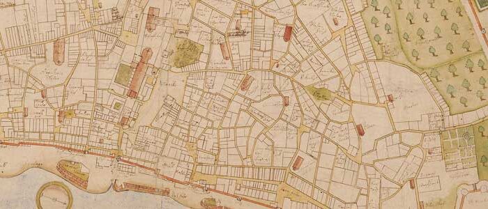
Developed by the city archives in collaboration with the Mainz Municipal Data Center, the Digital House Register is a complex historical-geographical information system that provides access to the Mainz city map for the periods around 1450, 1620, and 1866/71.
By combining computer-assisted mapping with a database, it opens up completely new possibilities for visualizing and using spatial information. The Digital House Register is intended to document the development and transformation of Mainz over the centuries and offer all interested parties a comprehensive, quickly searchable reference work on the history of the houses and their inhabitants for specific periods of time.


Three plans for the years mentioned contain information about previous names, changes, owners, and residents of houses in Mainz, including floor plans, elevations, and other illustrations, which can be accessed via an information tool. A map zoom function allows individual sections to be displayed.
In addition, a full-text search for house names and, for the 1866/71 plan, also for addresses (street name and house number) is integrated. Since the individual plans can be arranged transparently on top of each other, placed side by side by opening another monitor window, and additionally combined with the current city base map, the development of the city can be clearly traced by comparing individual time periods.
Technical information
Map bases
House register 1450
House register 1620
Fortress 1866 / House book 1871
House register 1946
Use on the Internet
The geodata in the Digital House Register can be displayed, navigated, and queried on the Internet using Mapbender (a project of the Open Source Geospatial Foundation). Optimal use is possible with the following browser versions:
- Internet Explorer version 6.x or higher
- Mozilla version 2.0 or higher
- Google Chrome